Canada

11 AUGUST 2017, 07:56 PM
High Bridge Ranger Station (PCT mile 2569) to Manning Park, BC, Canada PCT mile 2658) the end.
This concludes the entire 1001 mile backpacking trip starting from Seiad Valley California to Canada.
The monument marking the northern terminus of the PCT is right on the boarder with Canada. From here there are 2 options. Continuing into Canada for 8 miles and getting a bus at Manning Park, or returning south for 30 miles to Harts Pass and hitch hiking out. I chose the former.
It rained last night. After 50 days of sunny weather it finally rains on the last night. On the good side, the smoke is gone.
One evening a deer showed up at my site. I tried to shoo it away, but it pay no attention. It was back the next morning. By then I realized that it was expecting to be fed. It came as close as 5 feet. So I just took a picture.

photo 20170814 671163

Yoyo

05 AUGUST 2017, 06:24 AM
Stevens Pass (PCT mile 2461) to High Bridge (PCT mile 2569)
I am in a little resort town called Stehekin, picking up my last resupply package. Next stop Will be the end of the hike in Canada.
The trail makes a serious of ups and downs on this section. Starting from a low valley it climbs up a high ridge line, just to descend to the even lower valley behind, and then climb an even higher ridge. The elevation profile looks like an expending zigzag increasing in amplitude and duration as you go north. The last leg of this yoyo is still to come climbing from High Bridge 1500 ft to the next pass at 7000 ft. Needless to say there is major elevation gain and loss each day hiking this area. With careful planning I was able to avoid an 8500 ft day, but still had a couple of days with 6800 ft of climbing. You can I imagine the scenery of switching from a low lush vegetation covered valleys to high sub alpine ridges. Unfortunately, I cannot enjoy the scenery, because of the lingering smoke.
I met a couple of hikers Highway and Dash We are camped together a couple of nights and at the same time at Stehekin. Highway is continuing to Canada on the same itinerary as mine, so I will probably see him again.
The bright spot in the first image is the sun.

Heat and Smoke

02 AUGUST 2017, 06:45 AM
Snoqualmie Pass (PCT mile 2390) to Steven Pass (PCT mile 2461)
The Northern Cascades are rugged and must be beautiful. The valleys are deep and there are many lakes. The ridges are steep and allow distance views. I just wish it wasn’t as hazy.
It’s been hot the last 3 days. Temperature in Seattle were supposed to reach 100. On the trail at 4000-5000 it was on the 80’s and 90’s. On top, wild forest fires in western Washington spread smoke and haze over the area. Not exactly ideal conditions for either hiking or photography.

Washington Mid Point

White Pass (PCT mile 2292) to Snoqualmie Pass (PCT mile 2390)

The PCT goes through the edge of Mount Rainier National Park with fantastic vista of the great volcano. It is so close it fills up most of the view to the west. Along the way, Chinook Pass offers access to the area for the locals, and since it was the weekend, the area was very busy. Father north, it was not the local traffic, but the south bound through hikers that were increasing in numbers.

Where is Chugchug

Mount Rainer from Rainier NP

Chinook Pass and Sheep a lake

Lakes along the PCT

Volcanos

Trout Lake (PCT mile 2216) to White Pass (PCT mile 2292).

The trail goes above the tree line in several places to offer fantastic views of the volcanos in southern Washington.

There were quit a few local hikers in this section, probably because of the good views that it offers. There were also more south bound through hikers. It seems the trail has come to life. At the pass I met several through-hikers picking package our just resting.

Where is Chugchug

Mount Adams

Mount Rainier

Washington

Cascade Locks (PCT 2144) to Trout Lake (PCT 2226)

Crossing the Bridge of the Gods was somewhat emotional for me. It represented the half way point of my journey, the completion of Oregon and the beginning of Washington. It is a narrow, 2 lane bridge, and there is no pedestrian sidewalk. You simply walk in the traffic lane. It was early and not much traffic, so I was able to switch sides a few times to take pictures. At the end there was a big sign saying “Welcome to Washington.”

Trout Lake is a very hiker friendly little town some 13 mile of the PCT. It has many trail angles who will pick you up and take you back to the trail. The store will hold your package, no charge. The hotel will let you use there bicycles, etc. I am really happy I stopped here.

Next section of the trail is going by mount Adams, and I am really looking forward to the vistas.

Area map

Bridge of the Gods

The Columbia River

Mount Adams

Bridge of the Gods

Mount Hood Timberline Lodge (PCT 2094) to Cascade Locks (PCT 2144)

The last couple of days I hiked the northern most section of the PCT in Oregon. The trail went through an area called Paradise Park. Indeed it is an amazing display of glacier fed streams and an abundant of water. 

I was going to take the Eagle Creek trail which is an alternate of the PCT and suppose to be spectacular. However, the trail was closed due to an on going wild fire. It is amazing that just a few days ago the problem was to much snow.

Tomorrow morning I am going to cross the Bridge Of the Gods (actual name) and enter the state of Washington.

Area map

Mnt Hood and the Sandy River

Ramona Falls

Wild fire in Eagle Creek

Portland

Big Lake Youth Camp (PCT mile 1992) to Mt Hood Timeline Lodge (PCT mile 2094)

I am sitting at Timeline Lodge waiting to my ride to Portland. I am going to spend tomorrow shopping to replace some of my very worn out gear and then return to the trail to continue north. I am just 3 hiking days from completing Oregon.

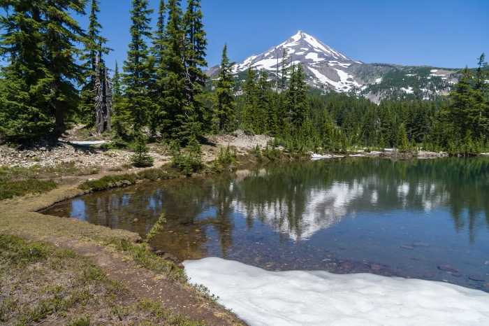
The highlight of this section is the Mount Jefferson Wilderness. Below are pictures of There Fingers Jack and Mount Jefferson from Shell Lake. As I other high elevation places in Oregon this year there was plenty of snow, but not enough to get me off course.

Where I am

Oregon “Green Tunnel”

Mt Hood

Mt Jefferson from Shell Lake

Three Fingers Jack

Sisters

10 JULY 2017, 09:08 PM
Elk Lake (PCT mile 1950) to Big Lake Youth Camp (PCT mile 1992)
The highlight of this section is the Sisters Wilderness and the Obsidian area. The PCT makes a large arch around the Sisters Mountain Range rising in altitude to 6500 ft. It offer fantastic views of the mountains and far away vistas to the west, not at all a “green tunnel”. The area had gobs amounts of snow covering the trail for miles making a GPS an essential navigation tool. The area is also very popular by locals. I met many hikers on several days backpacking trips through the area.
Below are pictures of Sisters Mirror Lake, South Sister from the trail, Middle Sister and North Sister from my camp.
The Big Lake Youth Camp is a must stop for every through hiker – free meals, shower and laundry. And you can send them your resupply package.
With this segment I have completed a third of the way to my goal, Canada.

South Sister from Sister Mirror Lake

South Sister

Middle Sister

North Sister

Elk Lake Resort

07 JULY 2017, 07:20 PM
PCT mile 1950
Most of what I read about the PCT route through Oregon talks about the "green tunnel". That feeling of seeing nothing but trees. While there is some true to it, they forget to mention the many beautiful lakes. Below are just a few examples taken from: Diamond View Lake, Charlton Lake and Taylor Lake.
Saturday I setup my camp on a spit of land extending into Dumbbell Lake. I had a 270 degrees view of this beautiful tree lined lake. To boot, there were no mosquitos.
Sunday morning I am at the Elk Lake Resort. I am going to rest and reorganize and continue tomorrow.